Showing posts sorted by date for query iuss. Sort by relevance Show all posts

June 24, 2026

Might Canada Choose a KSS-III Sized "DSME-3000" Without VLS?

Arising from SubMatts last future Canadian submarine article of June 19, 2026 was how much we still don't know.

Canada may be deciding next week or next month which of the two submarine types (built by TKMS and Hanwha Ocean) its going to chose. 

Even though a German/Norwegian TKMS Type 212CD has not evens been launched there is more certainty about its design (particularly it not having a Vertical Launch Systems (VLS) and its displacement being (right sidebar) 2,500 tonnes (surfaced) and 2,800 tonnes (submerged). Also (right sidebar) are two torpedo tube launched missiles under consideration - being the likely Tomahawk sized anti-ship and land attack NSM-SL,[20] and likely Harpoon sized - for anti-ship only 3SM Tyrfing[21][22]

It is about the other contender, the already launched South Korean KSS-III Batch-Is or Batch-IIs that there is more uncertainty. This is because Canadian officials and the military leadership have not officially stated whether Canada wants VLS in the KSS-III. 

VLS may weigh up to 800 tonnes. So VLS or no VLS is an issue impacting the KSS-III's whole design, including every buoyancy and trim calculation.

Complicating the KSS-III Batch-I or II picture are two never built "Export variants" of the KSS-III, that don't come with VLS. They are known as the DSME-2000 (2,000 tonnes) and DSME-3000 ("3,300 tonnes") (the KSS-III Batch-I is 3,305 tonnes (surfaced). In terms of length the DSME-3000 design is "83.5 meters" as is the KSS-III Batch-I.

If Canada picks a KSS-III it may be a Batch-I (with VLS) already operational or a DSME-3000 paper design - with the same dimensions, but without VLS. 

A KSS-III Batch-I or II with 6 or 10 VLS for missiles may be seen as an encumbrance given Canadian submarines' projected (?) standard mission profile of quiet surveillance. 

Comparing their structure and operation for degree of discretion relies on data that would only be available after an at sea runoff in 10 years time - data that would be, in any case, highly classified.

Comparing the DSME-3000 design's 3,300 tonnes and 83.5 metres exceeding the Type 212CD design's 2,500 tonne and 73 metres equals 800 tonnes and 10.5 metres greater. This may contribute to:

Improved speed, range and endurance of the DSME-3000; more diesel fuel; larger AIP machinery more AIP chemicals; more Lithium-ion Batteries; a greater electrical load for more powerful sensors and processing power; more food, space and comfort for a mixed gender crew; on longer patrols; and, more heavyweight torpedo tube fired shots (torpedoes, missiles, mines and UUVs and remotely operated seafloor sensor/IUSS maintenance robots).

But again, NATO alliance solidarity may trump South Korea's larger, likely more capable design. Canada might decide on the winning sub before NATO's July 7-8, 2026 NATO Summit, to be held in Ankara, Turkiye.

January 11, 2026

Canada Linking Submarine to Auto Joint Ventures: TKMS Advantage on Naval Specs?

Canadia's Industry Minister Melanie Joly (good looking! :) is requiring Germany and South Korea, which want Canada's submarine contract, to facilitate significant automotive production commitments (build factories) on Canadian soil. See the January 9, 2026 Korea Times article at this https://www.koreatimes.co.kr/amp/business/companies/20260109/canadian-sub-deal-hinges-on-carmaker-cooperation

Pete Comment

VW may lead the German automotive push. It sells more autos that are perhaps more price competitive than Mercedes, BMW, Porsche or Audi. South Korea, with car production dominated by price competitive Hyundais and Kias, may have an industrial advantage over Germany. Also the increase in Germany's defence spending, due to Russia-Ukraine, may reduce Germany's ability to raise offset money for Canadian car factories.

--------------

Since I wrote "TKMS-Canadian Marmen Collaboration: Has Type 212CD Won the CPSP?" on December 22, 2025, on traditional naval criteria TKMS may be ahead in the future Canadian submarine competition (CPSP).

A factor that may favour the TKMS Type 212CD is TKMS' decades of experience of anti-Russian operations in very cold water - something SK's submarine builders cannot match. It is possible that in cold water the Type 212CD may have advantages in Lithium-ion Batteries, AIP and sonar compared to the Hanwha Ocean's KSS-III – although this is dependent on submarine development years away and is classified. Also the NATO First Policy, perhaps most overtly voiced by the UK in 2025, favours NATO nation (Canadian and German) solidarity.

The Canadian armed forces are some of the personnel manning the IUSS (NATO aligned) seafloor and tethered sensor network mainly aimed at Russian submarines. Canadian submarines help weaponize this IUSS network. See https://gentleseas.blogspot.com/2022/05/us-uk-canadian-undersea-surveillance.html

Another factor that may favour the German-Norwegian designed 212CD is that Canada is building 8 x Norwegian designed Harry DeWolf-class offshore patrol vessels. These vessels, at 6,500 tonnes, are ice-breakers - hence adapted to cold water operations.

July 29, 2025

2nd Response to WahooDaddy - Australia need be passive on Taiwan's Defence

On 7/28/2025 12:53 PM WahooDaddy commented in red. My responses are in black:

Working as a coalition, with the Aussies and JMSDF and other regional partners, what d'you think the subsurface warfare scene would be like in the South and East China Seas?

Quite complicated - see my previous article for Maps and the US-Western allies'  IUSS. Many naval coalitions have a history of inefficiency in terms of interoperability (communication including language, standard procedures, common weapons and ammunition). See the weak and poorly coordinated American-British-Dutch-Australian (ABDA) Command easily destroyed by one country, the Empire of Japan, in early 1942.

Without full US involvement, with its internationally dominant submarine force and its full access to the IUSS undersea sensor network, regional countries with significant submarine forces (Japan, South Korea, Australia, Vietnam, Singapore, Taiwan (in about 5 years) and others) would be too weak to face the PRC Navy. 

This is considering the PRC has SSNs, large forces of conventional submarines, anti-submarine: surface vessels; UAVs; UUVs; satellites; large maritime patrol and carrier aircraft and land based missile torpedoes. 

The PRC likely has built up its own "IUSS" (weaponised with smart mines and submarines)  with many undersea arrays in the open, straits and narrows of the East China and South China seas. The islands the PRC has seized in the South China Sea present excellent platforms for criss-crossing undersea arrays.

Do RAN/JMSDF subs have the endurance to stick it out against the PLAN? If the balloon went up with the PRC invading Taiwan, would the RAN/JMSDF hang back, or try to support kicking the PLAN back from their ops in the Taiwan Strait?

No, the RAN has long transit distances, northwards, from its submarine base at Fleet Base West, south of Perth. Also other Australian bases are very distant for our slow diesel powered ships and subs to help Taiwan. The RAN would have trouble (our subs running out of fuel and food) discretely patrolling for PRC subs and surface ships passing through the Malacca Straits. So the RAN has to operate south of those straits. 

RAN Collins subs running their diesels, probably make them too noisy in the South China Sea against an enemy like the PRC. Japanese subs (all shorter range) cannot patrol much further south than the Luzon Strait, though when using air independent power (AIP) they are at least quieter. Singapore's force of 4 to 6 conventional subs (with AIP) are best placed to quietly shadow the PRC's conventional subs, but are very unlikely to attack them.

If the PRC invaded Taiwan the RAN, with a destroyer and frigate, moving as fast as the slow (15 knot cruise speed) supply ship probably would be too late and weak to  take on PRC forces. For speed and discrete movement Australia needs SSNs to be relevant in a PRC war against Taiwan. We are unlikely to have fully manned Australian SSNs until the late 2040s.

Japan is already better placed in seas south to Taiwan. But again, without US involvement all the allies would hang back because the PRC navy is too powerful in ship numbers, nuclear propulsion, emerging full sized aircraft carriers and long range anti-ship (and maybe sub) missiles. 

The picture would become considerably more complex if Russia and North Korea coordinated actions with China. Such as North Korea bombing or invading South Korea and Russia embarking on other territorial objectives in Putin's playbook.

I'm trying to look at it from a non-US perspective. I appreciate your thoughts and feedback!

No worries :) We'll talk off-line about what you're doing with these views.

Cheers Pete

1st Response To "WahooDaddy" - Some Water Space Considerations

Subsurface issues concerning the South China Sea and East China Sea are very complex and interconnected with physical and human matters.

For example in Part One of August 1, 2016, I argued China's 4 to 6 x Type 094 "Jin class" SSBNs in China's "naval Bastion" between the PRC mainland and First Island Chain (see Map A below) may continue to be too limited in capability to be effective, due to:

-  geography - very shallow water around China's SSBN Base at Yulin,
Hainan Island
 then a restricted South China Sea operating area, then sea depths too shallow especially south of Indonesia's Natuna Islands (see Map B), 
-  094s are known to be too noisy to be as stealthy as US, UK and French SSBNs
-  PRC commanders and crews lack operational SSBN patrol experience
-  the JL-2 SLBMs missiles with a range of around 8,000 km are too limited to hit US mainland targets from the protected (near Chinese) waters the SSBNs have to operate in. 
-  JL-3 SLBMs of the mid 2020s with a 10,000+ km range that might reach the US mainland can apparently fit in 094s
-  China's military-political command and control system may not be flexible enough to allow SSBN commanders to carry armed JL-2s or JL-3s or deliver the codes commanders to launch. Basically against Communist Party's tight control of military.


Map A above - The inner "J" indicates China's "First Island Chain" is where China's four Type 094 SSBNs are effectively restricted. These SSBNs are based in China's South Sea Fleet bases (Map A above) specifically at Sanya/Yulin Naval Base on Hainan Island. Moving outside that chain would take SSBNs away from protective Chinese aircraft and these SSBNs would need to pass between island narrows where undersea sensors (see Map C) and enemy aircraft, surface craft, SSKs and SSNs are likely to be waiting.
---

Also the following could intervene into the South China Sea to destroy Chinese SSBNs: enemy aircraft and submarines from Vietnam, Singapore (passing through the Philippines) also submarines further out from Guam, Japan, Australia, Hawaii and US West Coast. 


Map B above - The water (ideally 1,000+ m deep) restricts the already narrow South China Sea operating area and the sea becomes radically too shallow (less than 100m deep) south of Indonesia's Natuna Islands.
---

Useful water depth for a submarine could be all the way down to "crush depth" which may be 1,000+ meters for a Chinese SSBN. While deep water past crush depth (maybe 1,000 meters) may not benefit a submarine there is a correlation between depth and usable surface area.

The lack of adequate 1,000+ meter depth in large areas of the 3,500,000 square kms South China Sea may limit usable SSBN operational area to less than 2,000,000 square kms.

This reduced area to cover with sensors makes it easier for the US to lay seafloor or tethered sensors (including 
IUSS SOSUS) in and around that reduced usable SSBN area.

Tethering means that even in a 2,000 meter deep area a sensor with a 1,200 meter long tether (from the seafloor) would be very useful detecting Chinese SSBNs.


Map C above - Map depicts some of the likely Western SeaWeb IUSS 
undersea sensor array positions. Chinese, Russian and North Korean submarines and surface vessels are likely to be of most sensor interest. (
Map from page 54 “Map 4. The US ‘Fish Hook’ Undersea Defense Line” of the late Desmond Ball and Richard Tanter, The Tools of Owatatsumi Japan’s Ocean Surveillance and Coastal Defence Capabilities (2015, ANU Press) http://press-files.anu.edu.au/downloads/press/p309261/pdf/book.pdf?referer=444 . 
---


FURTHER COMMENT

I've made many generalisations that might be disputed by reading other websites and documents including:

-  http://thediplomat.com/2015/05/strategic-warning-and-chinas-nuclear-posture/

-  US DoD's "Chinese Military Power 2016") large PDF at:
  http://www.defense.gov/Portals/1/Documents/pubs/2016%20China%20Military%20Power%20Report.pdf


-  rightwing US and most Taiwanese websites should be treated with caution as they might tend to exaggerate China's SSBN "threat" as being serious and current.

China may take 25 years to attain the quality of US, UK and French SSBNs of today and to develop a JL-3 or a JL-4 SLBM with the range and accuracy of the Trident II SLBM.

Also see: 

Pete

June 29, 2023

B. Collision With Seafloor Destroyed Titan?

On June 26, 2023 I looked at "A. Mixture of Pressure Hull Materials Failed Titan?" in a spontaneous way. 

My alternate "B." way of thinking is that:

-  after an event happened while descending
-  like fire, perhaps with rapid gas release (too fast for the crew to put on their respirators) 
-  causing major interruption to steering
-  caused Titan to hit the seafloor
-  almost instantly distorting Titan's pressure hull
-  in turn causing the USN recorded implosion.  

Large portions of Titan are being retrieved from the seafloor in record time. These and smaller bits of Titan and even the remains of the 5 crew, may reveal why Titan failed. 

Under theory B. the cause might originate from battery management failure (especially from more fire prone Lithium-ion batteries) causing fire might be discernable due to burn marks on Titan parts and sadly on human material.

But as this video here (from 2:05 to 3:15) illustrates the beginning of compression of air (similar to a diesel piston) can cause sparking, fire and explosion in just a few milliseconds. At almost the same instant implosion of a submersible is proceeding. A few milliseconds later another explosion “pushes out” the implosion, scattering a submersible’s bits over a relatively wide area. This implosion-then-explosion was presumably the one event heard by the USN IUSS seafloor sensors.

All this complicates the job of examiners studying a Titan fire line of enquiry.

However, if enough battery material can be recovered, a study of its eventual chemical state and other Titan parts might reveal whether fire was caused by:

-  a runaway battery heat buildup and/or
-  a spark igniting a release of battery gas, or
-  igniting Titan's oxygen rich environment

all preceding Titan hitting the seafloor and then almost instant implosion. 

The carbon fiber (for all its possible technical pressure hull failure faults) might also be useful in revealing any prior melting that was different from any burn marks of flash caused be implosion. 

Yet, contrary to the hitting the seafloor theory - it is puzzling that such Large parts (like the part below) have been recovered rather than being imploded-exploded into tiny pieces. This may suggest a less rapid implosion occurred near the surface, say 500 meters down - and then the pieces sank to the seafloor. That would be more in line with theory A. Mixture of Pressure Hull Materials Failed Titan?" in a spontaneous way.


So this whole issue remains a contradictory intellectual challenge, that sadly involves loss of life.

June 23, 2023

US IUSS Sensors Precisely Knew Titan’s Implosion Location

It is no surprise part of the tragedy reported today: 

“After the [Titan submersible] was reported missing, the U.S. Navy went back and analyzed its acoustic data and found an anomaly [a very loud sound] that was “consistent with an implosion or explosion in the general vicinity of where the Titan submersible was operating when communications were lost,” a senior Navy official told The Associated Press on Thursday. 

The official spoke on condition of anonymity to discuss a sensitive acoustic detection system. 

The Navy passed on that information to the Coast Guard, which continued its search because the Navy did not consider the data to be definitive." 

The “sensitive acoustic detection system” is called the Integrated Undersea Surveillance System (IUSS) (some details below). The many sensors of IUSS, some relatively close to the Titan implosion and many more distant in the Atlantic Ocean, would have very accurately triangulated the precise location (rather than “the general vicinity”) and time of Titan's implosion off the US/Canadian coast. 

A major and understandable concern of the IUSS organization, which is part of US Naval Intelligence, ultimately relying on the NSA, was that the covert sources and methods to process the large amount of Titan implosion data not become a major public issue.

The main job of acutely precise IUSS sensors in the Atlantic Ocean are to detect and track the very small sounds made by Russian nuclear submarines. Undersea implosions are relatively easily heard compared to submarine movements. 

It took the availability of an overt source/sensor (a rare, very deep diving, remotely operated vehicle (ROV) to find fragments of Titan on the seafloor) to make it a public fact that the fate of Titan was now known. It was also out of concern for the next of kin that they shouldn't be told out of nowhere "secret sources, that we can't talk about, indicate your loved ones are dead..."

Some Details of IUSS

On June 20, 2023 I wrote of the importance of “fixed undersea sensors” to hear sounds made by Titan. These sensors principally mean ordinarily Top Secret seafloor microphones. In reference to Titan the microphones precisely locating the implosion are strung along:

1.  the Atlantic coast of the North American continent (including Canada)

2.  from northern Canada, to Greenland, to Iceland and then on to northern UK

3.  other relevant microphones protect the US nuclear submarine test ranges in the Bahamas, Caribbean Sea.

The location and large number of these microphones make triangulation of the implosion more precise.

These microphone arrays are operated by US, Canadian and UK naval personnel as part of the worldwide Integrated Undersea Surveillance System (IUSS) network.

From time to time these microphone arrays (a niche type of signals intelligence) become a semi-public issue, like now. Then the existence of IUSS quite literally submerges, being quickly forgotten by the public. 

For much more about IUSS see this Submarine Matters article of May 17, 2022. 

May 18, 2022

Australia and Possible IUSS Connections


Ultimately operated by the US-Canadian IUSS Pacific-Indian Ocean, Naval Ocean Processing Facility, Whidbey Island, Washington State, is the following. Above is the track of an IUSS undersea array from Japan, through Southeast Asia, to India. Many customer countries, such as Australia, would use the array's data to keep an eye on interesting submarines, like China's. 

Note the Indian Ocean point of the "hook" terminated at India's Andaman & Nicobar Islands but now extends to Chennai, Indian mainland. Source the late Desmond Ball's and Richard Tanter's, The Tools of Owatatsumi Japan’s Ocean Surveillance and Coastal Defence Capabilities (2015, ANU Press) page 54, Map 4. 

For submarine operations and for IUSS acoustic sensors a great many temperature, salinity, wave motion, seafloor geography and baseline acoustic measures are required to feed supercomputer records of US Naval Intelligence in conjunction with the NSA. Such an amount of data permits 3D modelling.

America's Five Eye partners all do their bit to collect data using sensors on submarines, ships, wave-gliders, AUVs and floats. Floats and AUVs might be assigned certain depths from the surface down to 2,000 meters. After several months the floats or AUVs come to the surface to radio the vast amount of data they have collected or rendevous to be "captured" by friendly ships.

The environmental including acoustic records held on board submarines are tailored to their missions and are constantly updatable. They assist submarines to move discretely and improve the efficiency of IUSS undersea sensors, frequently assisting ASW operations. 

The Royal Australian Navy (RAN) constantly conducts measurements often in the context of Australia dual civilian-naval Integrated Marine Observing System (IMOS).   

IMOS uses passive acoustic hydrophone equipment to monitors natural and "man-made noise sources". Such sources include submarines, surface ships and even maritime patrol aircraft and helicopters flying over hydrophones. 

Hydrophone arrays are strung together physically-electrically (or within acoustic communications range) and are connected to shore stations. For Australia data is then fed  constantly by landline, radio or satellite to major naval bases like Fleet Base West (near Perth) and East (in Sydney). All feeds would also go to Defence HQ Canberra. 

Feeds may be transmitted almost instantly to subs, ships and aircraft pursuing targets or land processed to improve the "picture". Feeds may also go to Five Eye allies and Quads (India and Japan). 

Returning to Integrated Marine Observing System (IMOS) in more detail:

The RAN and Australian Defence Science and Technology (DST) Group would not be the largest "Operational Partners" of IMOS unless there were concrete military advantages.

As Australia's submarines operate out of Fleet Base West, just sould of Perth, eastern Indian Ocean littoral and deeper oceanic conditions are of major interest.  


Courtesy "IMOS in Western Australia" See a much larger, more readable image here.
---
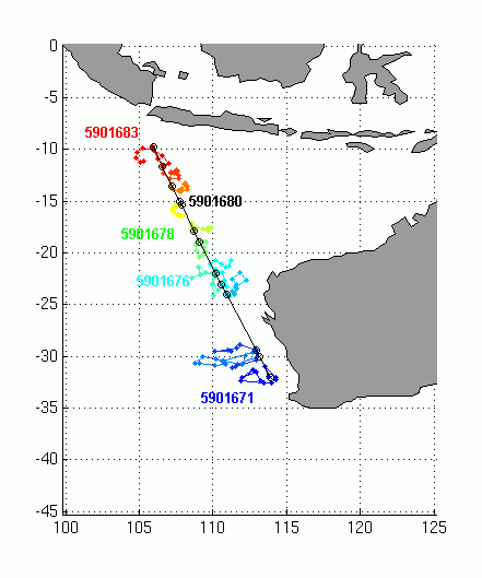
The map above relates to IMOS Indian Ocean Deployments including an IMOS technician who dropped Argo Floats along the track above. 
---

Just Guessing the Following


One could assume from the float track immediately above that an IUSS array from Fleet Base West to Australia's Cocos-Keeling or Christmas islands may be a good idea.

Moving west an array from one of those islands to the US/UK base at Diego Garcia might be a useful Five Eye project. India might also be a customer for that feed data. 

From Diego Garcia an array might be well placed to terminate at the US Naval Base at Djibouti. See map below.


Separately an array from Fleet Base West to the seabed north of Antarctica might be a useful way to intercept Chinese SSNs and future SSBNs which may travel the more discrete east to west route south of Australia through the Southern Ocean.

All guesswork.

May 17, 2022

US, UK, Canadian Undersea Surveillance IUSS Official Site


The following is a continuing project that I’ll incrementally add to. The US Navy Integrated Undersea Surveillance System (IUSS) website https://www.csp.navy.mil/cus/ intermittently disappears – so below is a (hopefully) lasting public record.

Only in the US does a highly sensitive IUSS have a public website shopfront. The website can be read from the Antarctica to Northern Fleet, Russia. Replacing the well known Cold War North Atlantic US, UK and BTW Canadian SOSUS system is the IUSS which is much more diverse in sensors and allies.

IUSS exists in the highly classified distributed Intranet of the US Navy. All major navies, like Russia’s and China’s, have their own IUSS. Smaller Western navies, or navies well disposed to the US, have varying degrees of access to the mainly US paid for and managed IUSS. The IUSS has as many mobile nodes as the fixed nodes that are easier to picture.

Western and allied submarines, maritime patrol aircraft, naval surface ships and some USNS ships are themselves mobile IUSS nodes. Also see https://www.navy.mil/Resources/Fact-Files/Display-FactFiles/Article/2222990/ocean-surveillance-ships-t-agos/

Those mobile nodes with weapons, icluding land based anti-ship missiles and fixed and/or  mines weaponize the IUSS network.

It is a measure of IUSS’ distributed nature that it formally exists under Commander, Submarine Force, US Pacific Fleet. Yet its more immediate “Commander, Undersea Surveillance" https://www.csp.navy.mil/cus/ , is based on the Atlantic facing US East coast at Bullpup Street Virginia Beach, Virginia, USA.

I’ll run through the publicly available details of the IUSS.

About IUSS 

https://www.csp.navy.mil/cus/About-IUSS/

Mission Statement

To support antisubmarine warfare command and tactical forces by detecting, classifying, and providing timely reporting of information on submarines and other contacts of interest; to provide command of Naval Ocean Processing Facilities (NOPFs), to include direct tactical control of associated Surveillance Towed Array Sensor System (SURTASS) ships; to gather long term acoustic, oceanographic, and hydrographic information.

Additional Information:

The Integrated Undersea Surveillance System mission is multi-faceted, encompassing not only the operations of detection, localization and tracking of submarines and the collection of acoustic and hydrographic information, but also the maintenance of processing and communications equipment necessary to carry out the operational mission. 

Since the inception of the Sound Surveillance System (SOSUS) in 1954, personnel stationed at Naval Facilities, Naval Ocean Processing Centers, Joint Sites, training commands and on the COMUNDERSEASURV Headquarters Staffs in the Atlantic and Pacific Fleets, have pursued the Undersea Warfare mission.

[Data certified UNCLASSIFIED by DoD/DoN and IUSS Authorities]”

See many details of the “Origins of SOSUS” at https://www.csp.navy.mil/cus/About-IUSS/Origins-of-SOSUS/ up to 1954 – ending with:

“… In reflecting on the early years of SOSUS, what is most striking is how much was accomplished in remarkably short time. Certainly a major factor was serendipitous confluence of events – the discovery that low-frequency sounds could travel great distances in the ocean, the realization that submarines radiate identifiable low-frequency energy, and the pioneering work at Bell Laboratories on visual speech analysis. 

Ease of contracting was also an important element. The Navy’s resolve to conduct undersea surveillance was crucial. The commitment of WECo and Bell Laboratories and their decision to assign some of their best people to the project were of considerable consequence.

[Data certified UNCLASSIFIED by DoD/DoN and IUSS Authorities]”


Leadership
 

https://www.csp.navy.mil/cus/Leadership/

Captain Steven Faulk, “Commodore” 
https://www.csp.navy.mil/cus/Leadership/Commodore/

Gregory Schmeiser, Deputy Commander https://www.csp.navy.mil/cus/Leadership/Deputy-Commander/

CDR Craig Hempeck, Chief Staff Officer, https://www.csp.navy.mil/cus/Leadership/Chief-Staff-Officer/

CMDCM(SS) Jeffrey Barnes, Command Master Chief https://www.csp.navy.mil/cus/Leadership/Command-Master-Chief/


IUSS Commands [Typically larger Naval Bases host IUSS main oceanic "Command" bases (below) and US or allied (including Five Eye) Naval Bases host more minor regional IUSS bases that are off-shore of the continental US] 

https://www.csp.navy.mil/cus/IUSS-Commands/

Naval Ocean Processing Facility Dam Neck, Virginia USA, covers 

Atlantic Ocean Operations 

https://www.csp.navy.mil/nopfdn/  [also see  ]

Naval Ocean Processing Facility (NOPF) Dam Neck (DN) proudly boasts its mission, “To provide timely and accurate acoustic cueing to operating and supporting forces, and to conduct continuous maritime surveillance for homeland security 24/7/365.”

NOPF DN was commissioned in September 1979 and is a tenant command of Commander, Undersea Surveillance, a unit of Submarine Force, U.S. Pacific Fleet. As one of the few remaining Integrated Undersea Surveillance (IUSS) facilities,

NOPF Dam Neck has become the premier Undersea Surveillance Site, conducting operations throughout the Atlantic Ocean, North Atlantic, and Norwegian Sea. In May 2009, NOPF Dam Neck officially became a Joint Combined Command welcoming the United Kingdom Detachment and an increased area of responsibility. This expansion also made NOPF DN the largest contingent of United Kingdom personnel in the United States. It is comprised of approximately 300 Enlisted, 20 Officers, and 7 civilians from the US Navy, UK Royal Navy and Royal Air Force. Together, they are the cornerstone of the IUSS community.
 

Naval Ocean Processing Facility Whidbey Island, Washington State USA

covers Pacific and Indian Ocean Operations 

https://www.csp.navy.mil/nopfwi/About/  [Also see]

The mission of NOPF is to provide timely and accurate acoustic cueing to operating and supporting forces, and conduct continuous maritime surveillance for Homeland Security.

NOPF is divided into two major divisions that operate in the same facility- The shore side and the sea side (Sea Component West). The sea side consists of STG's that rotate out to the five SURTASS ships that operate under NOPF. The shore side has various rates that all support the operations watch floor in completing it's mission.

NOPF has approximately 325 enlisted personnel, 25 officers, a detachment of 30 Canadian forces personnel and 15 civilians. This is an excellent duty station which is located right off the water and near a beautiful cliff-side park. The parking is readily available and the building is the nicest on base. Leadership .

Canadian Detachment [at Whidbey Island]

https://www.csp.navy.mil/nopfwi/canadian-detachment/

Welcome to Naval Ocean Processing Facility Whidbey Island (NOPFWI). With your posting, you are about to join an exclusive bi-national team responsible for providing timely and accurate acoustic cueing to operating and supporting forces throughout the Pacific, and conduct continuous maritime surveillance for Homeland Security. I am pleased to extend a warm welcome to you on behalf of the Canadian Contingent.

NOPFWI is the pride of the Integrated Undersea Surveillance System; the workplace is modern and comfortable, and the equipment is state of the art. You can be assured that your tour in this new environment will be professionally challenging and personally rewarding.

As you may well be aware, the US Pacific Northwest is a beautiful part of the world in which to live. Oak Harbor is a pleasant community with most of the conveniences you should need. Vancouver and Seattle, each with their own attractions, are only two hours away. All this should combine to make your stay in the United States a full and enjoyable time. 

IUSS Operations Support Center (IOSC) Little Creek, Virginia USA

https://www.csp.navy.mil/SUBPAC-Commands/Support-Commands/Commander-Undersea-Surveillance/IUSS-Commands/IOSC-Little-Creek/

The IUSS Operations Support Center (IOSC), located on Naval Amphibious Base, Little Creek in Norfolk VA, is responsible for all aspects of logistic and technical life support for world-wide IUSS in-service assets, including eleven SURTASS ships, [ https://www.dote.osd.mil/Portals/97/pub/reports/FY2012/navy/2012surtass.pdf?ver=2019-08-22-111611-643 ] three IUSS Fixed Sites. The IOSC provides array support to all Navy combatant ships. Additionally, the IOSC acts as the In-Service Engineering Agent (ISEA) for the IUSS program.

As ISEA, the IOSC manages and directs the support of contractors world-wide, acts as the liaison to field activities and laboratories, and provides configuration management, engineering change, technical documentation, preventative maintenance, RM & A, and Planning and Engineering for Repairs and Alterations (PERA) support.

Resident Navy commands within IOSC include, SPAWAR Systems Center, Charleston, SC (SSCC), Navy Array Technical Support Center (NATSC), and Military Sealift Command (MSC). There are also a variety of Contract Companies working at the IOSC.

[Tomorrow: How Australia might tie in with all this. Certainly our subs, ships and MPAs.]

March 27, 2022

Australia & India Boost Indian Ocean Surveillance Links

Australia's Asia-Pacifice Defence Reporter APDR, on April 14, 2022, reported an Indian
P-8I maritime patrol aircraft was deployed to Darwin to exercise with a RAAF P-8A aircraft. 

Earlier Gessler, in very interesting March 24, 2022 posts (with Pete's comments in [...] brackets) wrote: 

An article was published in the Australian Financial Review (AFR) by Andrew Tillett   following up on the recently-concluded Virtual Summit between the Prime Ministers Modi of India and Morrison of Australia (which was incidentally right after PM Modi's in-person summit with the Japanese PM Kishida).

Tillett talks about an impending 'deployment' of Indian spy planes (journalist-speak for
P-8I maritime patrol aircraft) to Australia.
 [Pete comment: More in the "spy" sense P-8s can also be fitted with Airborne Ground Surveillance (optical, infrared, radar and signals collection sensors)].

As the AFR articles are behind a paywall, I'm only going to reproduce bits & pieces, and often paraphrasing: 

"The types of exercises [Australia has] done with the Indians in the past have been pretty light on, but this would be a step-up in terms of complexity. This is where we were 15 years ago with Japan: fairly uncomplicated maritime surveillance, then it becomes co-ordinating ships and aircraft at sea. Exercises are ladder of complexity and this is the first step being climbed." - said Peter Jennings of ASPI. 

Two examples of the previous exercises Mr. Jennings is alluding to are: 

https://news.defence.gov.au/international/poseidon-power-major-exercise and

https://indianexpress.com/article/india/india-anti-submarine-exercise-us-7710105/

The second AFR article, indicates: 

"After several years of Australia and India stepping up the tempo of joint military exercises, the leaders also announced an Indian maritime patrol aircraft would be deployed to Australia sometime soon as part of strengthening collaboration on maritime issues. 

It’s unclear where the aircraft will be based but it is expected that Australian aircraft will also pay a reciprocal visit to India, as the leaders spoke about the need to keep open critical regional maritime corridors..." 

The two articles draw a lot from the joint statements issued via official channels, though the joint statement did not actually mention any specifics of an aircraft deployment: 

https://mea.gov.in/bilateral-documents.htm?dtl/35008/JOINT+STATEMENT++INDIAAUSTRALIA+VIRTUAL+SUMMIT

The important part under the "Security and defence cooperation" section goes:

"[Leaders] welcomed enhanced maritime information sharing and maritime domain awareness...Leaders underscored the importance of reciprocal access arrangements in facilitating deeper operational defence cooperation and its contribution towards free and open critical regional maritime corridors."

I'm not entirely clear regarding the nature of the Indian P-8's visit. Though the line in the second article about it being 'based' as opposed to the reciprocal Australian aircraft's 'visit' is interesting, but I don't know if that is anything substantial to go on. But what I can tell you is that India has been wanting to operate aircraft out of Australia's Cocos (Keeling) Islands, [which sit in the Indian Ocean] for quite some time.

[Pete comment: Wikipedia states: 

"The 2016 Australian Defence White Paper stated that the airfield [on the Cocos Keeling's West Island] would be upgraded to support the RAAF's P-8 Poseidon maritime patrol aircraft.[53] "]

This interest is documented in publications as well...

https://www.lowyinstitute.org/the-interpreter/islands-opportunity-where-india-and-australia-can-work-together

https://www.idsa.in/issuebrief/australias-strategic-imperatives-in-indo-pacific-rpsingh-230222

The 'reciprocal' part may come in with regard to Australia's access to operate from facilities on India's Andaman & Nicobar Islands. [Pete comment: The Islands' capital, Port Blair, hosts several bases including Indian Navy and Indian Air Force].

Or perhaps even the new [South China Sea like] Indian base being built on one of Mauritius' two Agalega islands in the Indian Ocean. [Mauritius is Indian military dominated. The Agalega island might be available for Australian use or at least visits].


See an investigative video on the base here and above. The Indian base on the Agalega islands seems tailored for operations of Indian P-8Is or other large aircraft.

I'd wait and see regarding what kind of 'deployment' AFR is talking about (because it could simply be another joint exercise). But as a closing note, I'd say that in addition to building Domain Awareness underwater (such as through 'Fish Hook' 

[older, deep oceanic term "SOSUS" and the modern, broader term US "IUSS" network. Also see SMI's references to IUSS] 

it is also important for QUAD nations to extend that cooperation into Surface, Air and Space domains. This is in order to build and maintain a full spectrum of surveillance and domain-awareness capabilities against PLAN activities in the Indo-Pacific, which would only be growing by leaps and bounds in the coming years and decades.

[Please link the above with Submarine Matters' September 11, 2018 article Japan-US-Indian IUSS cable link completed across Bay of Bengal ]