Reuters reports, October 20, 2020 on the Indonesian rejection: https://www.reuters.com/article/us-indonesia-usa-exclusive/exclusive-indonesia-rejected-u-s-request-to-host-spy-planes-officials-idUSKBN2750KX
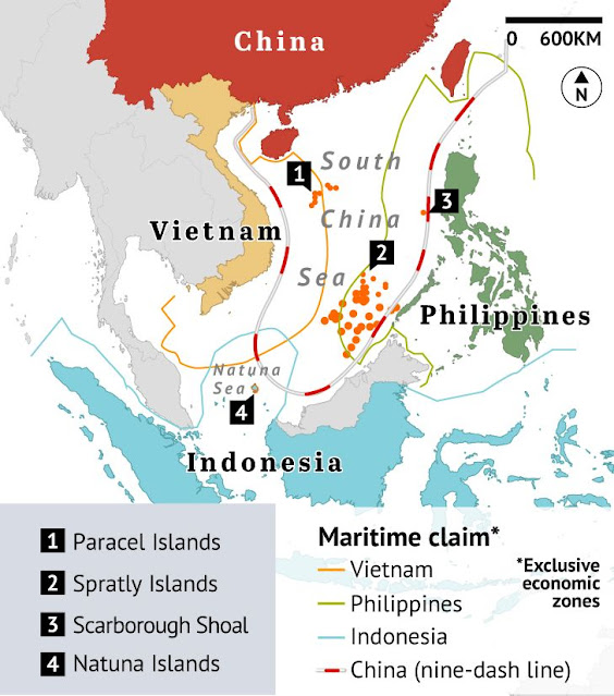
The map above marks Indonesia's Natuna Islands (point 4) which are geographically at
the center of Indonesia’s seaspace claim into the South China Sea – a claim
which partly overlaps with China's so-called nine-dash line that envelopes most of the South China Sea. (Map courtesy Asia Maritime
Transparency Initiative via the Sydney Morning Herald)
---
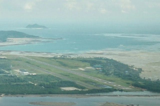
Above is the Indonesian civil-military airport on Natuna Besar.
---
---
Both the map and photo are from James Massola’s and Amilia Rosa’s, Sydney Morning Herald article of June 27, 2020, reporting an ongoing geopolitical Indonesia-China
standoff, at https://www.smh.com.au/world/asia/natuna-an-idyll-on-the-front-line-between-indonesia-and-china-20200617-p553g2.html.


No comments:
Post a Comment